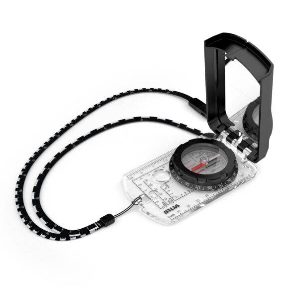
Tilt the Ranger 2.0’s mirror to roughly 45 degrees and you can sight along the baseplate at a distant feature while reading the bezel in the mirror at the same time. That is the point of a sighting compass, and it is what makes a bearing taken over open ground worth trusting. Around it Silva has built the rest of a serious map tool: a declination adjuster, a clinometer, scales for both metric and United States topographic maps, and a lanyard that doubles as a distance rule.
Key features
- Mirror sighting lid, so the target stays in the sight while the bezel is read in the mirror
- Built-in adjuster for magnetic declination, set once for the area you walk in
- Clinometer for slope angle, useful both for judging avalanche ground and for the extra distance a climb adds to a leg
- Magnifying lens, silicone friction feet and a turnable capsule for use with the Silva 1-2-3 system
- DryFlex rubber grip, and a Swedish steel needle running on a sapphire jewel bearing
- Detachable safety-release lanyard printed with 1:24k, 1:25k, 1:50k and 1:62.5k scales, supplied with a slope card
Specifications
- Accuracy 2 degrees; graduation 360 degrees
- Baseplate scales: 1:25k, 1:50k, millimetre, inch, 1:24k mile and GPS scales
- Folded size 60.5 x 110 x 20 mm (2.4 x 4.3 x 0.8 in)
- Weight 86 g (3 oz)
- Operating temperature range -20 to +60 degrees Celsius (-4 to +140 degrees Fahrenheit)
- Materials: acetal, acrylic, PC/ABS and TPU; luminous markings good for about four hours once charged in light
It suits the walker, hunter or rescue volunteer who navigates by map and bearing and wants an instrument that rewards care. Three honest points. The luminous markings are charged by daylight or a torch and give roughly four hours, so they will not see you through a long winter night. Silva publishes no global needle for this model and lists a separate Global version in the Ranger line, so treat this one as intended for the hemisphere it is sold in. And a declination adjuster is only as good as the number you set into it: take that figure from a current topographic map, and re-check it every few years, because magnetic declination moves.